Mueller Inlet Camping: A Remote Croajingolong Escape, VIC
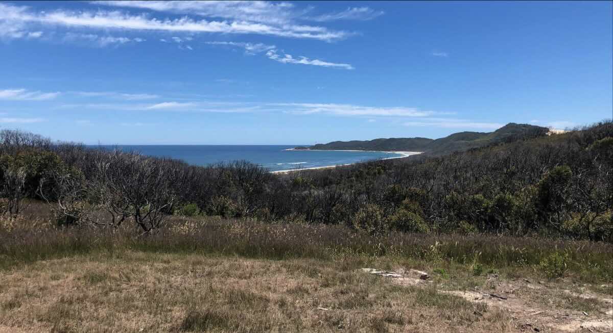
For those seeking a true wilderness experience, Mueller Inlet Campground offers a cosy and remote base to explore the pristine beauty of Croajingolong National Park. Nestled on the banks of the Mueller River, this small campground overlooks the expansive inlet as it winds towards the ocean. Protected by a large dune system covered in beautiful banksia woodland and coastal heath, it’s a tranquil spot where the sounds of nature dominate. This is a destination for the self-sufficient camper who values solitude and the opportunity to connect with an untouched environment. The campground is a paddler’s dream; with motorised vessels prohibited on the inlet, the calm waters are perfect for exploring by canoe or kayak.
The campground is small and intimate, with only eight unpowered sites, three of which are designated for walk-in campers only, further enhancing the sense of seclusion. Access is via the unsealed Point Hicks Road from Cann River, and the final track into the campground can be challenging, making it best suited for tents and camper trailers. Facilities are basic, with non-flush toilets provided, but campers must bring their own drinking water and be prepared to take all rubbish home. Due to the high fire risk in the dense vegetation, campfires are not permitted at any time, so gas stoves are essential for cooking. The rewards for this self-sufficiency are immense: fantastic fishing for estuary perch, incredible birdwatching opportunities, and a profound sense of peace. It’s also a great base for exploring the nearby Thurra River Dunes and the historic Point Hicks Lighthouse, making it a perfect stop on a Far East Gippsland adventure.
Campground Details
- Name: Mueller Inlet Campground
- Address: Point Hicks Road, Point Hicks, VIC 3890, Australia
- GPS Coordinates: -37.777740458378815, 149.323387236374
- Website: Parks Victoria – Mueller Inlet
Park Facilities & Information
- Location: Croajingolong National Park, on the shores of Mueller Inlet.
- Road Access: Via unsealed Point Hicks Road and Bald Hills Track. Access is weather-dependent and best suited for 4WD or high-clearance 2WD. Not recommended for large caravans.
- Site Surface: Natural earth and sand.
- Camping Permitted: Yes, paid camping in designated sites. Advanced bookings are required year-round via Parks Victoria.
- Maximum Overnight Stays: Check with Parks Victoria for specific limits.
- Facilities: Non-flush toilets.
- Potable Water: No. You must bring all your own drinking water.
- Mobile Phone Coverage: None. Expect to be completely offline.
- Onsite Public Toilets: Yes, non-flush toilets are available.
- Rubbish Bins: No. This is a carry-in, carry-out park.
- Open Fires: No, campfires are not permitted at any time. Fuel stoves only.
- Generator Use: No, generators are not permitted.
- Number of Sites: 8 unpowered sites (3 are walk-in only).
- Essentials to Bring: Drinking water, fuel stove, rubbish bags, insect repellent, and a Personal Locator Beacon (PLB) is highly recommended.
- Pet Friendly: No, pets are not permitted in the national park.
- Fishing: Yes, excellent estuary fishing from a canoe or kayak.
- Short Walks: Yes, explore the dunes and shoreline. The scenic walk from the day visitor area is 1.2km.
Nearby Amenities & Attractions
- Local Pubs:
- Cann River Hotel – Approx. 39 km
- Places to Eat:
- Cafes and takeaway in Cann River – Approx. 39 km
- Local Attractions:
- Point Hicks Lighthouse – Approx. 15 km (Check for road access)
- Thurra River Sand Dunes – Approx. 10 km (Check for road access)
- Croajingolong National Park – Onsite
- Nearest Alternate Caravan Parks:
- Cann River Rainforest Caravan Park – Approx. 39 km
- Bemm River Caravan Park – Approx. 60 km
- Alternate Free Camps:
- Murrungowar Rest Area (Princes Hwy) – Approx. 50 km
- Nearest Alternate Dump Points:
- Cann River Rainforest Caravan Park (check for public access/fees) – Approx. 39 km
- Mallacoota Public Dump Point – Approx. 100 km
- Nearest Petrol Station:
- Cann River – Approx. 39 km
- Nearest Alternate Drinking Water Resupply:
- Cann River – Approx. 39 km
Seasonal Weather Forecast
The weather in the remote Croajingolong National Park is mild but can be unpredictable and change quickly.
- Summer (Dec-Feb): Warm with average maximums around 25°C. Ideal for paddling and swimming, but be prepared for strong sun and insects.
- Autumn (Mar-May): Mild and often the calmest and clearest time of year, making it perfect for exploring the inlet.
- Winter (Jun-Aug): Cool and often wet, with average maximums around 14-15°C. Access roads can be slippery and challenging.
- Spring (Sep-Nov): Mild and warming up, with the coastal heathlands bursting into colour with wildflowers.