Gracie Lorimer camp area — Kevington, VIC 3723

★ ★ ★ ★ ☆
Community rating: 4.0 / 5

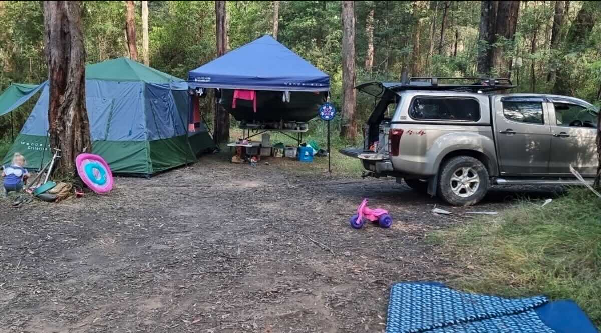
Gracie Lorimer camp area sits near Kevington in Victoria’s High Country and offers a peaceful riverside/bush camping experience for tent campers, small caravans and camper-trailers. The site is popular with fishers and families who want a quieter base to explore the Goulburn River and nearby walking tracks. It’s a good option for visitors seeking easy access to river swimming holes, short bush walks and historic High Country pubs. Expect basic on-site facilities, natural shade, and a relaxed rustic atmosphere — bring all essentials and treat the area with Leave No Trace principles. This page provides GPS coordinates, a satellite map, practical site details, nearby services (pubs, caravan parks and petrol), advice on water and waste services, and a brief seasonal weather summary for planning your visit.

  • Name: Gracie Lorimer camp area
  • Address: Kevington, VIC 3723 (informal/local camping area)
  • GPS coordinates: -37.3820, 146.2108
  • Official website: No dedicated campground website found (community listings available)
  • Satellite map (approx. location)

Practical site details

  • Site suitable for: tents, camper-trailers, small caravans (4WD access recommended for some nearby tracks).
  • Road access: sealed to nearby towns; local access may be gravel. Drive carefully and check conditions in wet weather.
  • Site surface: grass / natural ground.
  • Camping permitted: yes — community/free camping listings indicate informal camps in the Kevington area; obey signage and local rules. (Confirm on arrival.)
  • Maximum overnight stays: varies by specific reserve — some local free sites commonly limit 1–3 nights; check signage / council rules.
  • Facilities: basic — picnic tables and some public toilets at nearby reserves (e.g. Twelve Mile Reserve / Flour Bag Creek); limited formal facilities on small bush sites. See local listings.
  • Potable water: unlikely on-site — bring drinking water or refill at nearest town (Eildon / Mansfield).
  • Mobile phone coverage: patchy — Telstra tends to be the most reliable in the High Country; expect limited data in spots.
  • Onsite public toilets: available at some nearby reserves (approx. nearby free camps & reserves list available below).
  • Rubbish bins: limited; please pack out what you bring in.
  • Open fires: permitted subject to seasonal fire restrictions — always check current CFA / Parks Victoria rules.
  • Generator use: not recommended (quiet rural area); follow local guidelines if allowed.
  • Number of sites available: informal — variable and first-in basis (nearby formal campground at Kevington Hotel lists ~10 sites for its campground).
  • Essentials to bring: drinking water, cooking gas, fire safety gear, warm clothing (cold nights), insect repellent, basic tools, and a shovel for cathole waste if needed.
  • Pet friendly: usually pet-friendly at many nearby reserves — check signage and keep dogs on a lead.
  • Fishing: yes — Goulburn River fishing nearby (observe local regulations and seasons).
  • Short walks: small riverside and bush walks in the area; bring good footwear and insect repellent.

Nearby services & distances (approx.)

  • Pubs:
    • Kevington Hotel — on Woods Point / Mansfield-Woods Point Rd, Kevington (riverside pub & campsite). (On-site or within ~1 km). :contentReference[oaicite:0]{index=0}
    • Jamieson Hotel — Jamieson township (approx. 20–30 km by road; check route via Mansfield-Woods Point Rd). :contentReference[oaicite:1]{index=1}
    • Mansfield pubs & dining — Mansfield township (approx. 30–40 km by road). :contentReference[oaicite:2]{index=2}
  • Places to eat: Kevington Hotel (onsite bar/restaurant weekends & public holidays), plus cafés/restaurants in Mansfield and Eildon (30–40 km). :contentReference[oaicite:3]{index=3}
  • Local attractions: Goulburn River swimming & fishing spots, High Country scenery and short bushwalks; Mansfield region activities (mountain rides, wineries, local trails). :contentReference[oaicite:4]{index=4}
  • Nearest caravan parks: Eildon / Mansfield parks (e.g. Eildon Pondage Holiday Park, Mansfield Lakeside & others — 25–40 km). :contentReference[oaicite:5]{index=5}
  • Next free camps: Common nearby free camping spots include Twelve Mile Reserve, Flour Bag Creek, Tunnel Bend Reserve, Skipworth Reserve (see community listings). Distances variable (within ~0–25 km). :contentReference[oaicite:6]{index=6}
  • Nearest dump points: public dump point lists show options in the broader region (Mansfield / Eildon area) — use a dump-point finder / map for exact locations. :contentReference[oaicite:7]{index=7}
  • Nearest petrol (approx.): Eildon fuel outlets (Simpsons Fuel Eildon) and Mansfield service stations — plan fuel stops in Eildon or Mansfield (approx. 25–40 km). :contentReference[oaicite:8]{index=8}
  • Drinking water resupply & public toilets: available in nearest towns (Kevington Hotel may offer basic services; public toilets at some reserves like Twelve Mile Reserve). Confirm on arrival. :contentReference[oaicite:9]{index=9}

Seasonal weather summary (local High Country / Kevington area)

Kevington sits in Victoria’s High Country so expect cool winters with frosts and occasional snow on higher ground, and warm summers with the possibility of sudden afternoon storms. Average summer daytime highs tend to be in the low to mid-20s °C, while winter daytime highs can be single digits with nights near or below 0 °C. Always check the Bureau of Meteorology / local forecasts before travel and for fire danger ratings. :contentReference[oaicite:10]{index=10}